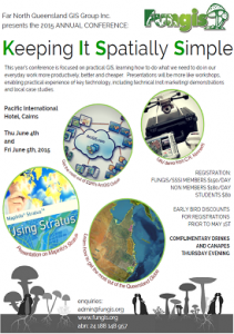
KISS - Fungis 2015 AGM - Keeping it Spatially Simple
When: June 4, 2015 8:30 am – June 5, 2015 5:00 pm
Location: Pacific International Hotel, Cairns, QLD, Australia
The theme is centered around practical GIS and learning how to do what we need to do in our everyday work, better, more productively and cheaper. Therefore this year's conference will not have presentations, but will have key technology, technical (not marketing) demonstrations and local case studies.
KISS - will focus on major cloud based GIS solutions and also practical UAV mapping.
This Fri - June 5th at 1pm at the Pacific International in Cairns -international expert Joe Francica will talk on The Hype Cycle. This session as well as the vendor hall is open to the public for free from 9am to 2pm with UAV's and cool mapping tech.
Joe is Pitney Bowes’ new global Managing Director of Geospatial Industry Solutions and is one of the top global influencers in the Location Intelligence (LI) industry. Joe will talk about key trends in the LI industry, what’s hot and what’s not, and how other organisations globally are using LI in ways never thought possible before, including Facebook and Twitter. Gartner places certain technologies along a curve to indicate whether it is is "over-hyped" or a technology that could be promising or is already being applied and provides business value. Joe looks specifically at location technologies that have been talked about as being promising as well. Some, telematics provide substantial value while the IoT (Internet of Things) is still nebulous and is perhaps over-hyped. He'll discuss 12 such location technologies and where he see their business value now and in the future but will put them in the context of how Gartner discusses other technologies. For more of his thoughts about how market research companies view geospatial information in Directionsmag.com .
The following will be structured as workshops where the speakers will walk you through typical problems and solutions using their platforms. We encourage you to bring your laptops with the software installed or talk to our experts before their sessions to get it working.
- Thu morning -Key Note and QGlobe/QSpatial with Steve Jacoby PSM
Steve Jacoby is the Executive Director of Land and Spatial Information (LSI) in the Department of Natural Resources and Mines (DNRM). The LSI division is responsible for spatial data, systems, services and infrastructure. Steve has chaired the Queensland Spatial Information Council (QSIC) since 2009, and represents the State Government on a number of spatial information expert panels, committees and boards.
Steve commenced his career with Land Victoria as a trainee then went on to lead the Department’s Land Information Group for seven years. In 2003, he commenced with the Queensland Government as Chief Information Officer for the Department of Natural Resources and Water.
Steve holds a Bachelor of Applied Science from RMIT University and a Research Master of Surveying Science (Information Technology)from The University of Melbourne. Steve is currently an Adjunct Professor with the Institute for Future Environments at the Queensland University of Technology (QUT).
Steve was awarded the Public Service Medal for services to land and spatial information in the 2014 Queen’s Birthday Honours List.
Queensland Globe presentation by Steve Jacoby
Steve Jacoby will show you how to view State Govt Data in Google Earth through Queensland Globe. Queensland Globe is a free plug-in developed by the Queensland Government. It allows you to view a wide range of spatial data through Google Earth, including:
-
addresses, localities and boundaries
-
road and rail networks
-
land parcels and tenure
-
areas affected by flood
-
topographical maps.
Imagery used is the latest and best available for public viewing. It consists of a single layer of either satellite imagery or aerial photography, with higher resolutions over built-up areas.
Through Queensland Globe, you can also search:
-
lots and plans—returns results for a property based on property descriptions from rates notices
-
QueenslandGovernment data—searches several datasets, including Queensland place names
-
addresses—finds results based on the address for a property.
Helen Moon (Senior Project Officer, Spatial Data & Mapping) in depth training session on Queensland Globe and QSpatial
Helen will run a more in depth training session on Queensland Globe and QSpatial. The Queensland Spatial Catalogue (QSpatial) is a Queensland Government initiative providing improved public access to a variety of spatial and associated data. You can discover, display, select and download or order data over an area of interest in selected formats, including map coverage data, image data and text file data.
- Download Queensland Globe and get a head start before the conference
- Thu lunchtime - Fungis AGM 2015-2016
All members are welcome and NEEDED!
- Thu afternoon - ESRI - ARCGIS Online
ArcGIS provides a practical, easy to use, yet powerful spatial analysis platform that connects maps, apps, data, and people so you can make smarter, faster decisions. Regardless of whether you are an experienced GIS analyst, a field worker, a spreadsheet ninja or a hotshot app developer, ArcGIS provides you with the tools to get the job done.
This workshop will take you through some common workflows that Keep It Spatially Simple while allowing you to drive real business outcomes in a cost effective and efficient manner.
We will look at: Esri Maps for Office; Web App Builder; Storymap Templates; App Studio and some other interesting developments in the world of Web GIS.
- Get ArcGIS online to get a head start before the conference.
- Thu night - Drinks and nibbles sponsored by Pitney Bowes with a UAV Demo by CR Kennedy
- Fri morning - UAVs with CR Kennedy and a Prosumer
Anton van Wyk will focus on “UAV workflow using Aibot X6 and Automated Ground Control Points with Agisoft”. We will look at how to make the workflow from flying a mission with a UAV to the final product more productive. Using the Inspire 1 and Aibot X6 UAV’s in comparison and also making use of the latest upgrades on Aibot X6 to improve data capture workflow. We will also look at using the automated markers from Agisoft and how this method can improve productivity and image processing more automated.
Anton has a background in civil engineering and worked for consulting engineers in road design. This led to software development and eventually worked with software vendors assisting with GIS development and implementation. He has been in the GIS industry for more than 17 years. Using his GIS and airborne data capture knowledge, he got involved with survey solutions using UAV technology. Anton is currently the National GIS and UAV Manager and Chief Operating Pilot for CR Kennedy
Local prosumer John Brisbin will demonstrate how we can utilize UAV technology on a day to day basis.. John has over 20 years of experience developing internet-based knowledge management solutions, including open source webmapping. He is also a practising Aussie, fresh FNQ resident, and complete noob when it comes to UAVs.
His journey started about 6 months ago with no experience in piloting RC aircraft, photogrammetry acquisition, or navigating CASA regulations. He explains: "I aimed to set a speed record in this sector as a crash-test dummy. I have learned a little bit about flight theory, pulse width modulation, how to solder, the joys of hot glue guns and duct tape, where to stand on a flight field full of scale model fighter pilots, what not to discuss with CASA, and the importance of safe operating parameters. If I can live through this process, anybody can."
John is not a commercially certified UAV pilot and does not offer his services as a UAV operator on a commercial basis. He notes: "This is an exploration: I don't think anyone knows what the 'killer app' will be for UAVs yet...that's what excites me about the evolution of this technology."
John will be sharing a selection of learnings and a bit of hands-on engagement during the session. Bring your own safety goggles!
- Fri mid-morning - Google Apps with GetBack2Basics
Forbes reports that cloud based solutions have grown from $77 Billion in 2012 to an estimated $210 Billion in 2016. Google Apps has been available for the last decade and allows users to do everything from general MS Office suite work to complex mapping and analytics. We will look at some of the apps that could give us free (or low cost) tools to improve our productivity.
- If you don't have a Google Apps account you can get one free from us - it will be FirstNameLastName@fungis.org
- Fri afternoon - Mapinfo
Joe Francica, the Managing Director of Geospatial Industry Solutions with Pitney Bowes International will talk to us about the Hype Cycle.
Recognised as one of the top 25 most influential people in geospatial technology by an independent survey by Boundless Geo in 2013, Joe Francica is one of the leading experts in Location Intelligence (LI) globally, having started the global Location Intelligence Conference in 2004. He has contributed to three books on the topic as well. Prior to joining Pitney Bowes, Joe was editor-in-chief of Directions Magazine for 13 years. His role is to drive the strategy and execution of the Location Intelligence line of business.
Joe will talk about key trends in the LI industry, what’s hot and what’s not, and how other organisations globally are using LI in ways never thought possible before, including Facebook and Twitter. Find out which GIS technologies are reaching the ‘plateau of productivity’ in the Gartner Hype Cycle.
Maria Xygkaki, Pitney Bowes’ Location Intelligence Consultant, will run a workshop that will take attendees on a journey of landscape monitoring and analysis using the all new MapInfo Pro Raster application. The exercises are related to fire event monitoring, hazards assessment or mitigation, vegetation regeneration for environmental and climate analysis, objects mapping and other uses. The workshop will offer the attendees the opportunity to work with Pitney Bowes’ next generation raster grid based add-on for MapInfo Pro and powerful grid Multi Resolution Raster (MRR) data format. Don’t miss it on Friday afternoon!
- Get Mapinfo Stratus to get a head start before the conference.