Practical Open GIS Workshop
When: November 28, 2014 9:00 am – November 30, 2014 1:00 pm
Location: Woodleigh Station, Ravenshoe
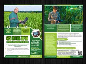
Do you want to visualise your property? Do you want to know how to get free spatial data over your property? Have you heard of Geographical Information Systems (GIS)? Do you think using GIS will cost you lots of $$$? How about only $250 upwards to learn how to in a weekend, with software and data that costs you nothing? You will gain enough practical knowledge to create maps yourself and leave with information on how you can get more done by applying spatial techniques.
View the Program here
- Do you want to visualise your property?
- Do you want to know how to get free spatial data over your property?
- Have you heard of Geographical Information Systems (GIS)?
- Do you think to use a GIS will cost you lots of $$$?
How about only $250 to learn how to in a weekend?
You will get enough practical knowledge to create maps yourself and information on how you can get more done by applying spatial techniques.
The Far North GIS User Group (FUNGIS) is organising a weekend program at Woodleigh Station near Ravenshoe from 28th to 30th of November 2014.
Join Us and get on the road to technology that will improve your productivity! Register Now
The Far North GIS User Group (FUNGIS) is a volunteer group established over 25 years ago. We are Geographical Information System (GIS) Officers and Surveyors, that want to help promote the application of spatial knowledge to problem solving.
A geographical information system (GIS) is a computer system designed to capture,store, manipulate, analyse, manage, and present all types of geographical (aka spatial) data. It is a tool to visualize data in several different ways in order to see patterns and relationships in a given area or subject. These patterns generally appear on maps but they can also be found on globes or in reports and charts.
A commercial software system used to be required to present data collected by downloading spatial data or integrating GPS collected data and related information. This has meant expensive training courses, purchasing software licenses and data. Commercial software can cost thousands and data can cost hundreds of thousands of $’s. Fortunately, open software and data is now available to fulfill at least the basic requirements, and what’s better - it’s absolutely FREE.
Volunteer programmers have built an open source mapping software system - Quantum GIS. QGIS can be downloaded and installed on most desktop computers and tablets (Windows, Linux, MacOS, Android ). Assisting QGIS is the open data policies of governments worldwide. State,Federal and local governments have released terabytes of open data to help the general community to make better decisions through spatial analysis.
This workshop will show attendees who have no prior experience with spatial sciences, GPS units or GIS systems, how to use this freely available software and data. Maps produced can be anything from recording where someone has been on their property to identifying the spread of weeds, fire management, optimum positions for trapping feral animals or counting grass to uncover the most economical and sustainable grazing system for a property.
View the Program here
We will be modifying this according to the participants interests, existing experience and requirements. We are creating a questionaire for this and will publish it shortly. Your input will help us deliver a better program to you.
Are you a GIS expert?
We recommend that you come for only Saturday and Sunday as Friday will be about introducing participants to the concepts of GIS and so we don't feel you would get much value from this time. Off course if you want join and enjoy the river and a walk around the Station, set up your camp etc on Fri, we would love to see you there.
CPD Points -
if you are an SSSI member you will get 17CPD points for attending the 3 day program.
Can't join us for the whole weekend?
We encourage you to come for the Gala Outback BBQ on Saturday night. Come at evening tea time with your family, enjoy station life and network with us. You will just need to pay $50 for access and the dinner and book at least 3 days in advance.
Costs
The following costs apply up to Nov 10th as early bird rates. After then $50 is added. Accommodation is not included in the rates.
- 3 Days (Fri Nov 28th morning tea to Sunday 30th brunch) is $250 for Graziers, Students and Fungis Members. It is $300 for others.
- 2 Days (Sat Nov 29th morning tea to Sunday 30th brunch) is $200 for Graziers, Students and Fungis Members. It is $250 for others.
- Saturday Nov 29th evening (evening tea and dinner) is $50 for everyone. Must book by Nov 26th. No late fees apply to this item.
Book your accommodation
http://www.woodleighstation.com.au is where we are at, tell them that you are with Fungis to get a special rate. Attendees can also stay in many motels and campsites in Mt Garnet, Innot Hot Springs and Ravenshoe which are less than 20mins away.
References
-
http://www.esri.com/industries/~/media/Files/Pdfs/library/ebooks/farming-the-future.pdf
-
http://geography.about.com/od/geographyintern/a/gisoverview.htm
-
QGIS Introduction : https://www.youtube.com/watch?v=1-tFlQPHhEk