Mapping River to Reef Workshop
When: February 21, 2009
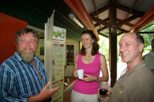
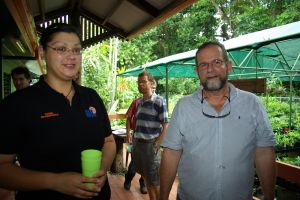
Friday 4 December 2009 at Mission Beach provided an informative presentation and discussion on spatial information and knowledge exchange initiatives supporting management of the Great Barrier Reef and associated water resources.
Fungis thanks all who participated in this informative workshop. Initiatives presented and discussed are described below. For further information on these please contact enquiry@fungis.org
Reef KML
Cherie Stafford, Spatial Data Centre, GBRMPA http://www.gbrmpa.gov.au
The Climate Change and Knowledge Management groups within GBRMPA have developed a framework to capture real-time status of reef health indicators and impacts using Google Earth KML technology. The Reef Health KML delivers (1) real-time links to outputs from databases such as BleachWatch, Eye on Reef, Reef Health Impact Summary and community provided qualitative information (2) increased capacity for GBRMPA to provide synthesised summary information over time which will allow trend analysis and progressive real-time monitoring and reporting on reef status (3) enhanced capacity for community and industry to provide GBRMPA with qualitative long term monitoring information and 4) compatibility with e-Atlas data synthesis tools.
New Reef Check Australia Survey Application
Gareck Packer, Reef Check Australia http://www.reefcheckaustralia.org/
This application was built to manage and maintain their historical and future repositories of some 500+ reef surveys, and provides online interfaces (both tabular and spatial) that have been made available to GBRMPA, AIMS and the wider community.
Using spatial information for water quality management in the Great Barrier Reef
Frederieke Kroon, Principal Research Scientist, CSIRO
Water Quality Improvement Plans have been developed for individual river basins on the Great Barrier Reef (GBR) catchment associated with the Reef Water Quality Protection Plan. Within each WQIP, the aim is to link marine ecosystem targets to end-of-river pollutant load targets, and to farm level management practice targets. The targets are linked through quantitative models e.g. one model connects GBR chlorophyll concentrations (marine target) to end-of-river nitrate loads, a second connects the end-of-river nitrate loads to fertiliser management targets in the catchment, while a third model links fertiliser application to nitrate loss at the farm scale. Here I discuss the target setting process used for the Tully WQIP, and the challenges to produce estimates from the models, with known levels of uncertainty, but robust enough for management purposes.
Further information on the science underpinning the development of the Tully WQIP is available at http://www.publish.csiro.au/nid/127/issue/5017.htm, whilst a more general overview of CSIRO water quality research in the GBR is available athttp://www.csiro.au/resources/GBR-Water-Quality-Overview.html.
e-Atlas- Australia’s tropical land and seas
David Souter, Research & Spatial Systems Director, Reef & Rainforest Research Centre
http://e-atlas.org.au/content/about-e-atlas
Under construction, the e-Atlas is a partnership between many research providers in order to develop a portal to information about Australia’s tropical terrestrial and marine environments. By providing the means to share and access data, maps and information on topics relevant to the region, the ATLAS aims to promote collaboration and support the work of management agencies, researchers, reef-based industries and community groups. Decades of research have generated a large amount of data and information on the Great Barrier Reef and the terrestrial tropical ecosystems. Until now this information has generally been under-used.
Qld NRM Knowledge and Information Network Project (KIN)
Reuben Sinclair, KIN Regional Coordinator (North)http://www.rgc.org.au/collective-projects
The Qld NRM Knowledge and Information Network Project is managed by the Qld Regional NRM Groups Collective (RGC) and has four part time knowledge coordinator positions. These positions work across the state with regional natural resource management bodies to capture existing information and knowledge management processes being used by regional NRM bodies, assist with information dissemination and will develop an agreed state framework for the future management of regional NRM knowledge in Qld in 2010.
Reef Rescue and Web GIS
Raymond De Lai, Herbert Resource Information Centre http://www.hric.org.au/
The HRIC has successfully implemented a world-class Enterprise GIS solution based around ESRI ArcGIS server architecture. The HRIC is now undertaking a strategic plan to identify HRIC partner requirements to identify how they can take advantage of the Enterprise GIS solution. A key priority identified will be the development of systems and processes to support improved outcomes for the Great Barrier Reef. This presentation will present on the Federal Government’s Reef Rescue program and the State Government’s Reef Regulation legislation, and the challenges and opportunities that it presents HRIC and partners.
Townsville City Council – Enterprise GIS
Kenneth Melchert,http://www.townsville.qld.gov.au/services/departments/land_info/index
An Enterprise GIS provides a geospatial solution for an entire organisation, allowing spatial enablement to its business processes and decision support. It connects knowledge and place and provides business value through both geo-centric and geo-enabled functions and workflows. This presentation will provide an overview of Townsville City Council’s Enterprise GIS and a number of major projects currently being undertaken by Townsville City Council. The focus of the presentation will be on the building of an Enterprise GIS and the delivery of a geospatial solution to meet the business requirements of Council and the community.